Grove Hall / Quincy Corridor
This page contains information about the Neighborhood Slow Streets plan for the Grove Hall / Quincy Corridor neighborhood.
Neighborhood Slow Streets is a new approach to traffic calming requests in Boston. We're focused on street designs that self-enforce slower speeds and safer behaviors. Through this program, we aim to:
- reduce the number and severity of crashes on residential streets
- lessen the impacts of traffic, and
- add to the quality of life in our neighborhoods.
Grove Hall / Quincy Corridor is one of five communities that was selected to join the program in 2017.
Construction 2021
Construction has begun! Installation of all the changes and accompanying signage will take three to four weeks to complete. You will see temporary signs and pavement markings while we work on completing all the changes that are part of the zone.
Construction update
Construction in the City of Boston has ended for 2021. We will resume construction in spring 2022. Construction is put on hold in the City of Boston when the weather is too cold for most materials to cure.
View the final plan!
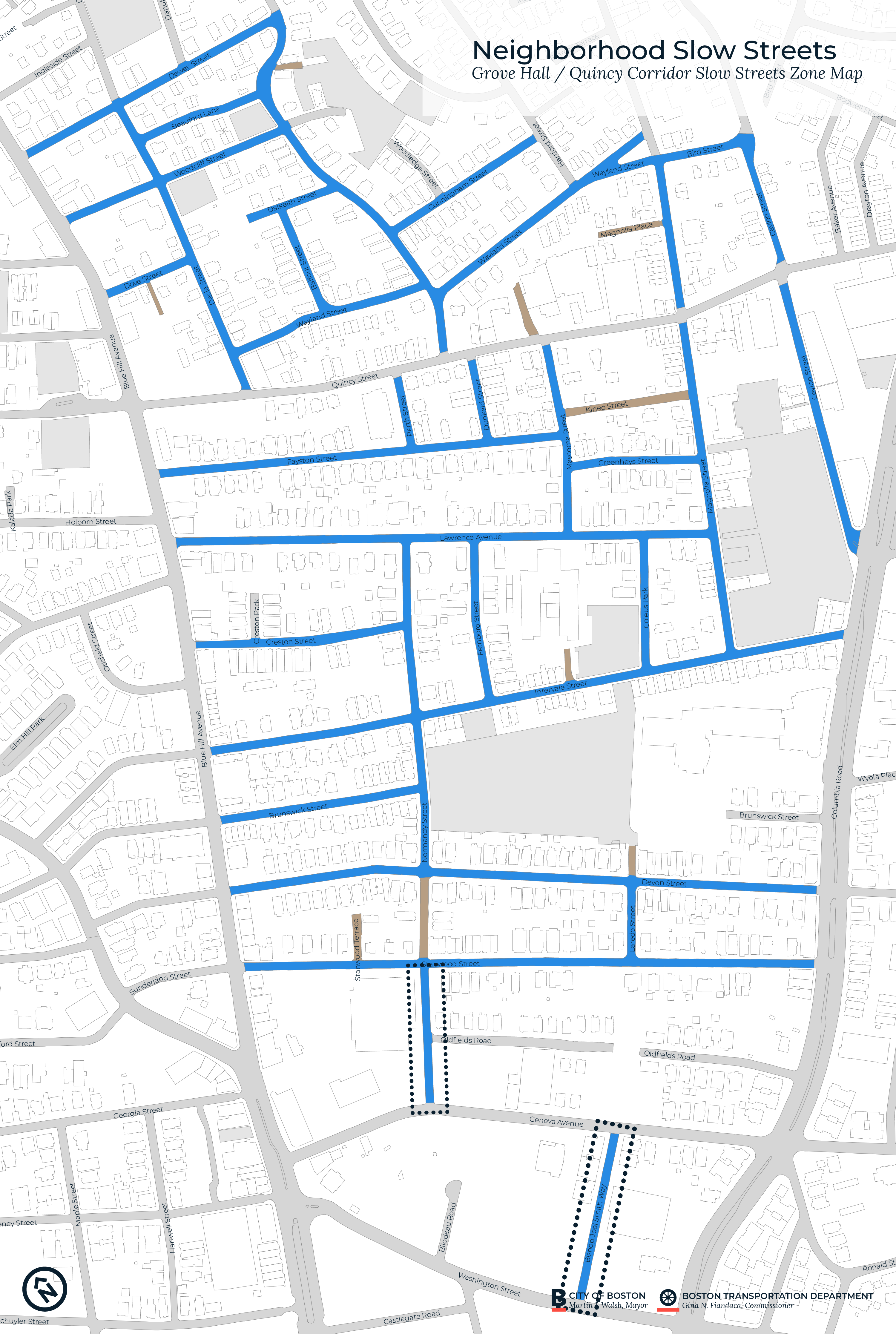
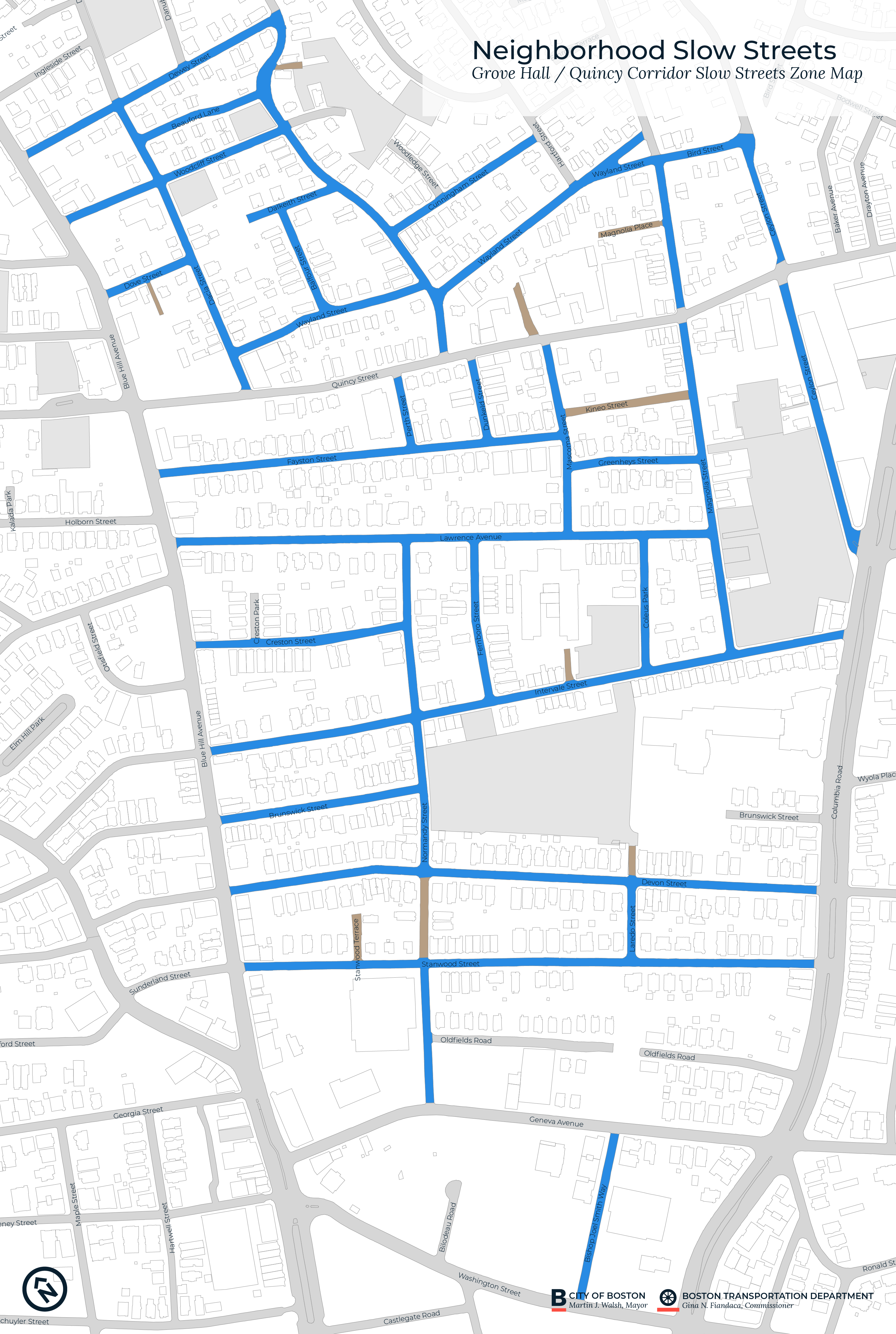
The map below shows the street design changes that we will install in 2021. Double-click the map to view it larger.
Closer look
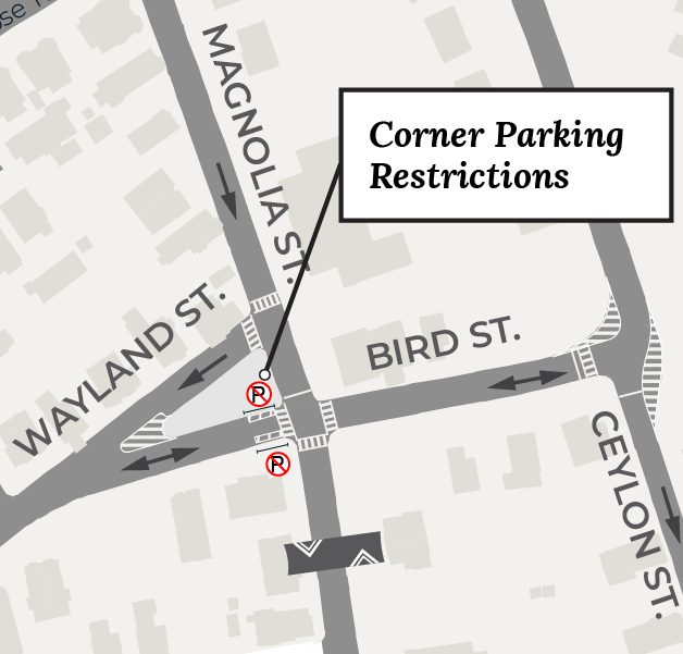
Wayland Street and Bird Street
We'll install pavement markings to better clarify the path of travel at Wayland Street and Ceylon Street and Bird Street.
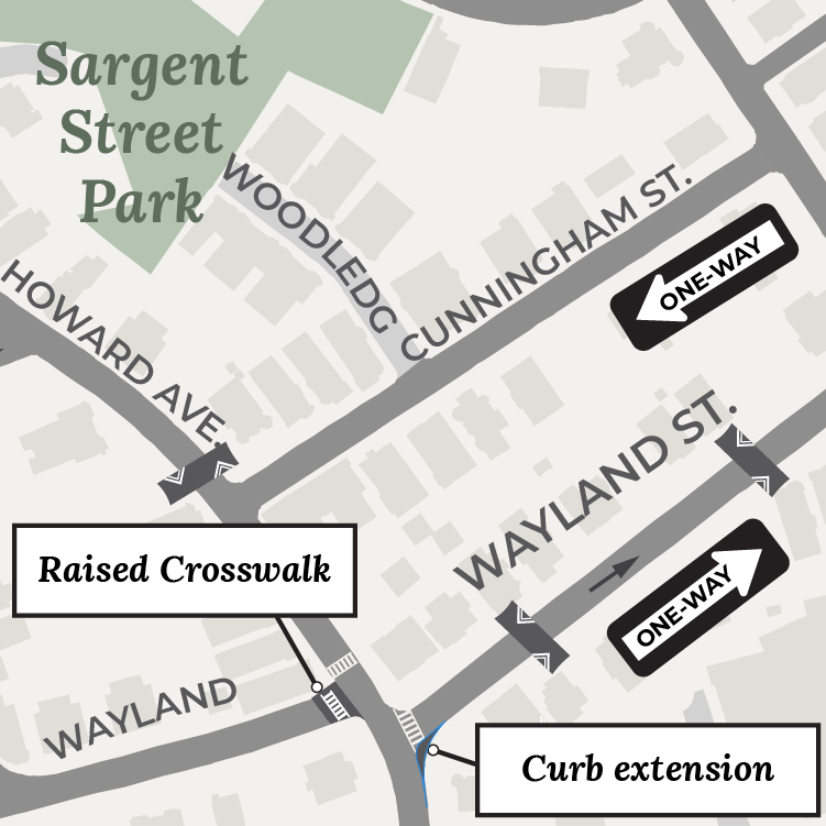
Wayland Street and Howard Avenue
We'll build a raised crosswalk across Wayland Street in front of the corner market. In addition, we'll add a curb extension to the southern corner of Wayland Street and Howard Avenue. This curb extension will shape this wide curve into a more regular, T-intersection. It will encourage drivers to slow down before turning.
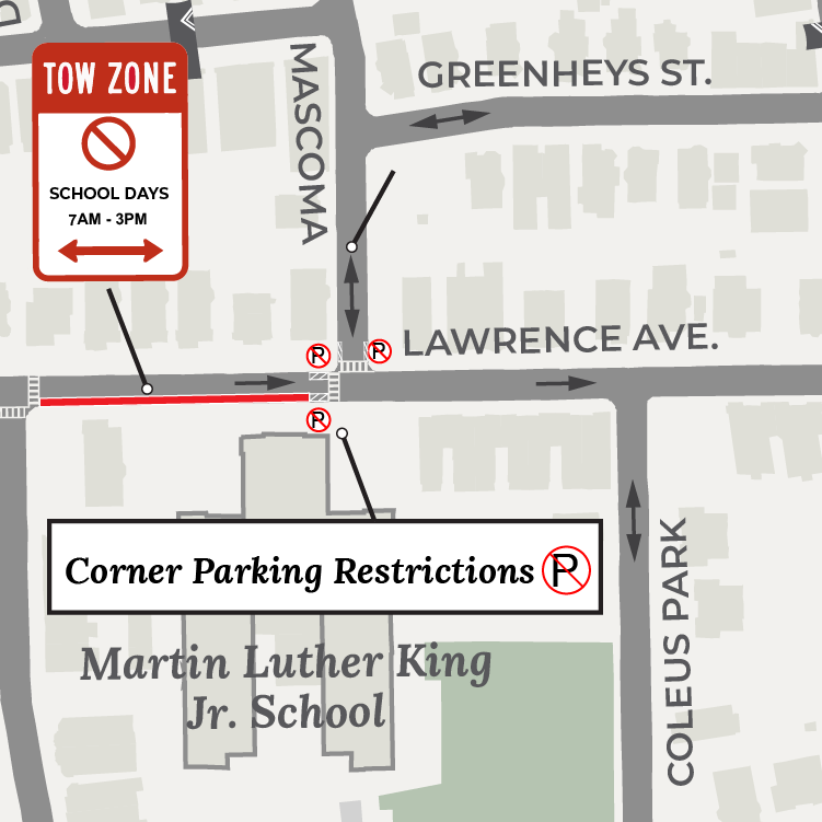
Lawrence Avenue and Mascoma Street
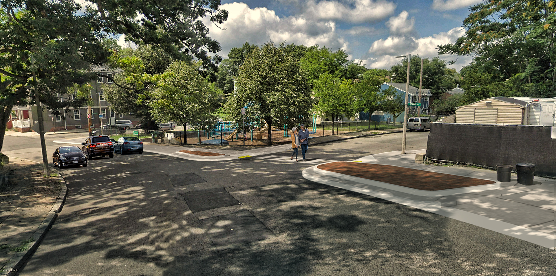
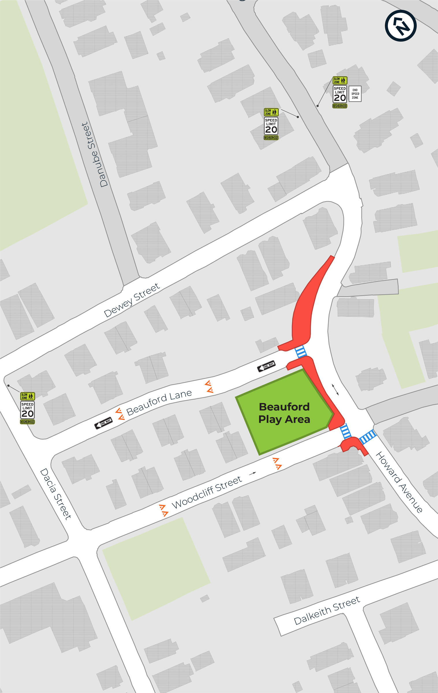
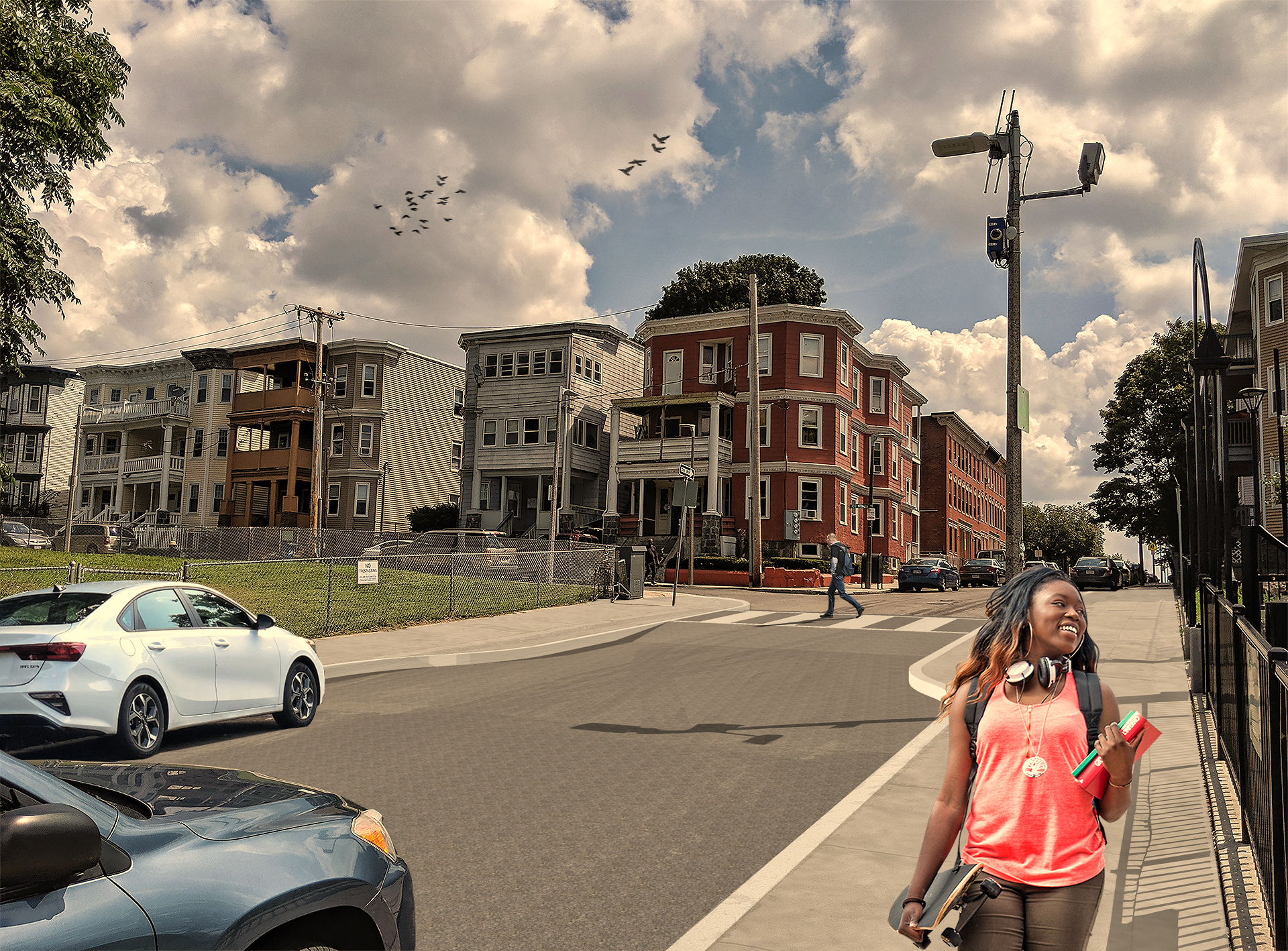
Howard Avenue and Beauford lane
Click image to view larger
We heard that drivers speed through the curved bend on Howard Avenue and turn sharply onto Beauford Lane. The new shape of the street will:
- discourage drivers from accelerating along the curve
- add buffer space between the road and people on the sidewalk, and
- create a safer crossing to the P.F.C. Willis Beauford Tot Lot.
The width of the street at this wide curve will be more uniform along Howard Avenue.
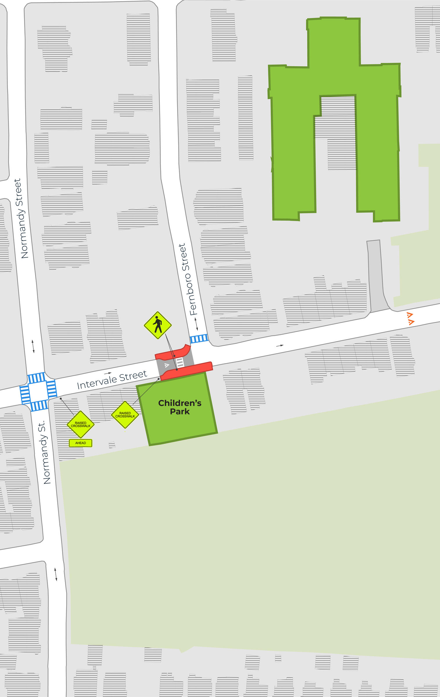
Intervale Street Raised Crosswalk
Click image to view larger
We'll build a raised crosswalk on Intervale Street near the Children's Park. A raised crosswalk is at the same level as the sidewalk. It slows speeds while creating a safer and more comfortable crosswalk. It's a friendlier crosswalk for children, older adults, or anyone experiencing challenges walking.
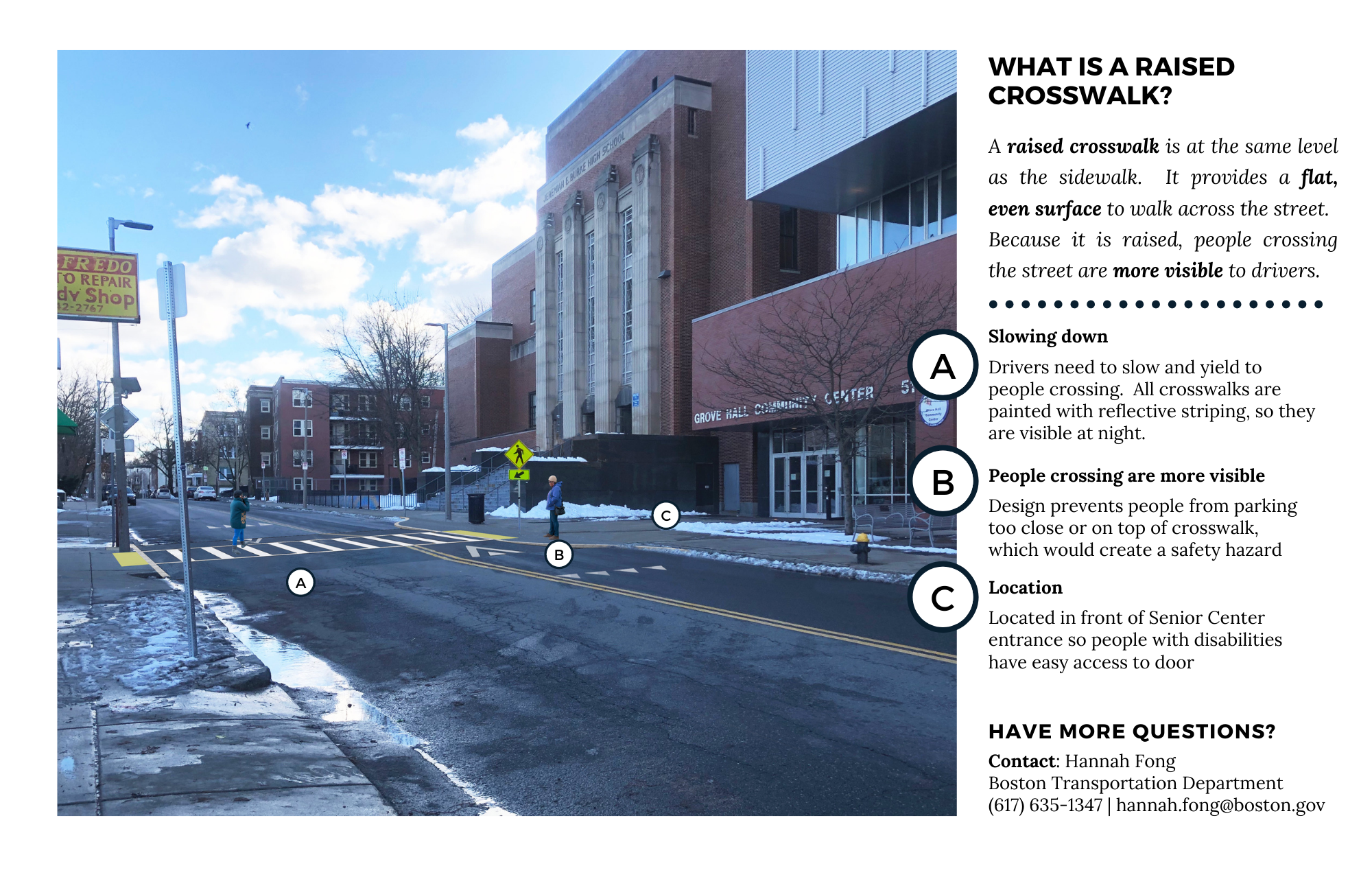
geneva avenue Raised Crosswalk
Click image to view larger
We are building a raised crosswalk across Geneva Avenue in front of the Grove Hall Senior Center. Read the PDF handout that explains this raised crosswalk in more detail.
Project History
HistoryThis year, we shared draft plans at neighborhood meetings, office hours, and community events. We reviewed feedback and updated designs to reflect community concerns.
Have questions? Contact Hannah Fong at hannah.fong@boston.gov or 617-635-1347.
We presented the following presentation at the Project Right community meeting on October 1, 2019.
We shared updates to the plan at the Project Right Meeting on 10/4/2019
We invited residents to talk to us one-on-one about the Grove Hall Neighborhood Slow Streets plan. We attended neighborhood meetings throughout the summer.
We hosted a public meeting on April 25 at Grove Hall Community Center. We are in the process of incorporating feedback provided through May 23.
Bishop Joe L. Smith Way and a small section of Normandy Street have been added to the zone. These two street segments are outlined with a dotted blue line on the map.
We joined community members for a neighborhood walk on Monday, September 18, at 4:30 p.m. We started at Wayland Street and Howard Avenue. What we learned from the walk will supplement information:
- received in the application
- reported through the Vision Zero Safety Concerns map, and
- collected through speed and volume studies.
Neighbors were welcome to join all or some of the walk. The walk was not the only time or place that community members can provide input on the Neighborhood Slow Streets project. Neighbors can also share their concerns on the Vision Zero Safety Concerns map or at future public meetings about the project.
After the May 31, 2018, public meeting, we collected feedback on the focus areas through an online survey. Community members were asked to share their ideas for:
- improving safety on streets near the Willis Beauford Tot Lot
- improving safety at the intersection of Wayland St and Howard Avenue
- improving safety near the MLK School (along Lawrence Avenue near Mascoma Street)
- improving traffic flow along Wayland Street, Cunningham Street, Bird Street, Magnolia Street, and Ceylon Street, and
- reducing speeds and improving safety on their street and at other locations.
We met with residents from 6 - 8 p.m. at the Grove Hall Community Center at 51 Geneva Ave.
Zone Map
*All streets that we will consider for changes are marked as "zone streets." During the planning process, we may determine that some streets won’t see any changes. We generally will not consider any additional streets that are not marked as "zone streets."
2017 Application Period
Neighborhood Slow Streets prioritizes street safety improvements in areas:
- with a history of serious crashes
- with a high number of residents more likely to be killed or seriously injured walking or biking (children, older adults, and people living with disabilities)
- that include places people may walk or bike to (schools, libraries, parks, community centers, bus stops, or transit stations), and
- near existing or planned opportunities for walking, biking, or taking transit.


